Pages

Wednesday, 30 April 2014

Day 24 Barkly Homestead Roadhouse to Tenant Creek

A strong wind arose overnight and was still with us in the morning as we set out to head 190km towards The Threeways, which is the intersection of the Barkly and the Stuart Highways.  The wind was at our tail so fuel consumption was improved. At The Threeways we turned south and 40 km later we were in Tenant Creek.  Both highways are excellent and weather was fine and warm.  The undulating tree-filled plains continued until just before Tenant Creek where red hills began to appear again.  Visited Lake Mary Ann about 5 km out of Tenant Creek.  Tenant Creek is not large but has a large aboriginal community, as evidenced by many aboriginal folk sitting around the town, together with their younger children.  It is also the home of the Battery Hill Gold Mine which does not operate now but has been redeveloped as a tourist attraction.  We did not take the underground mine tour this time.
300414 The Threeways - intersection of the Barkly & Stuart Highways


300414 The hills began to appear about 10km out of Tennant Creek 
300414 Lake Mary Ann 5km from Tennant Creek

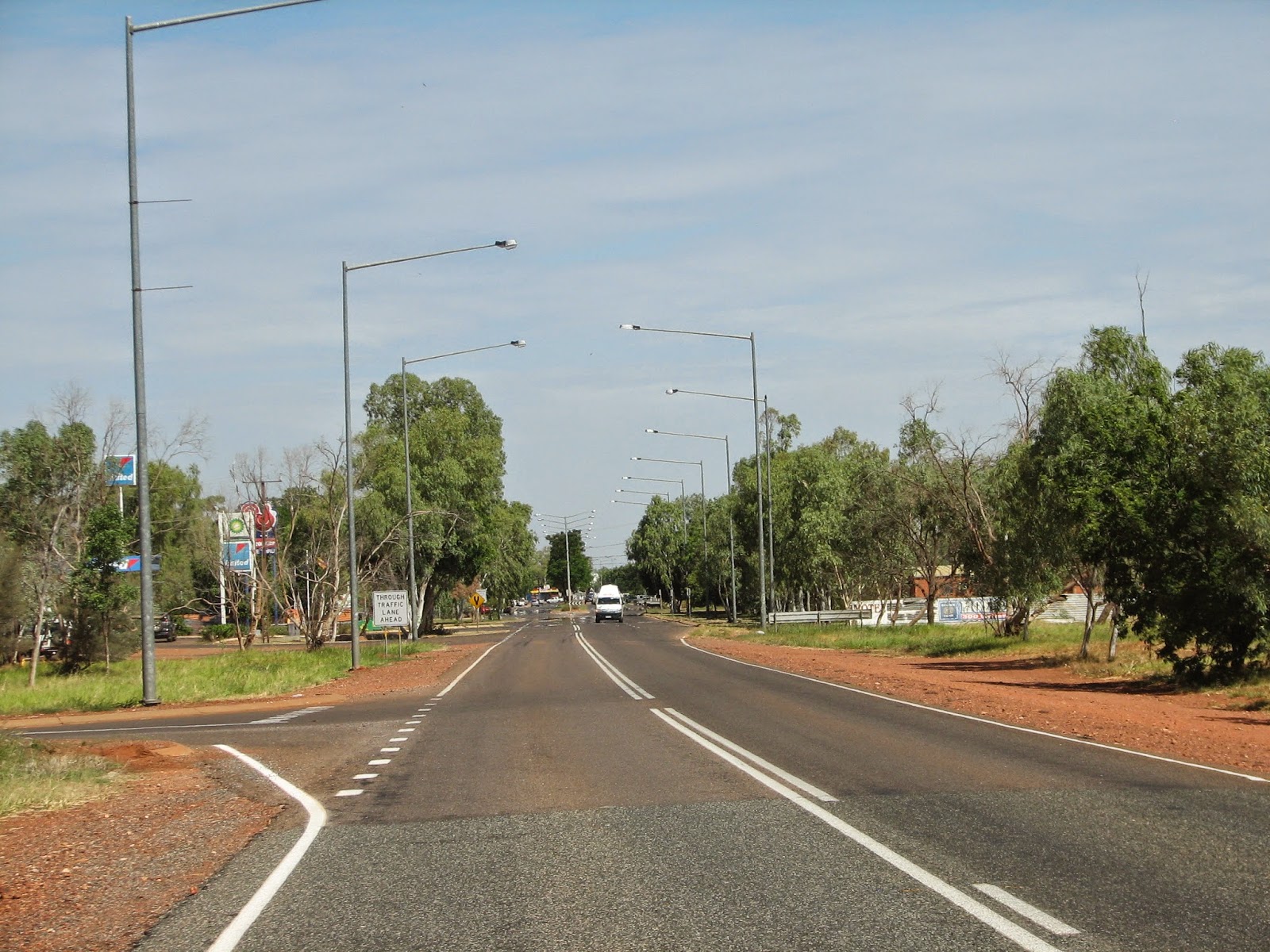
300414 Entering Tennant Creek along the Stuart Highway

Tuesday, 29 April 2014

Day 23 Mount Isa to Barkly Homestead

Last night we had a look at Mount Isa and the mine as the sun began to set.  It was spectacular.  Today, 450km along the Barkly Highway via Camooweal (population 310) had us into Barkly Homestead, about 260km into the Northern Territory.  The beautiful hills around the Mount Isa area gave way to Savannah like plains of almost canary yellow grass.  60km after Camooweal, the countryside changed yet again to undulating, tree filled plains.  The trees were slightly stunted with an occasional larger one.

Now for some trivia.
  • we saw only one house (at Soudan Station) in the 260km run from Camooweal to Barkly Homestead
  • once we left the colourful rocks at Mount Isa, only a single red coloured rock was in evidence right through to Barkly Homestead
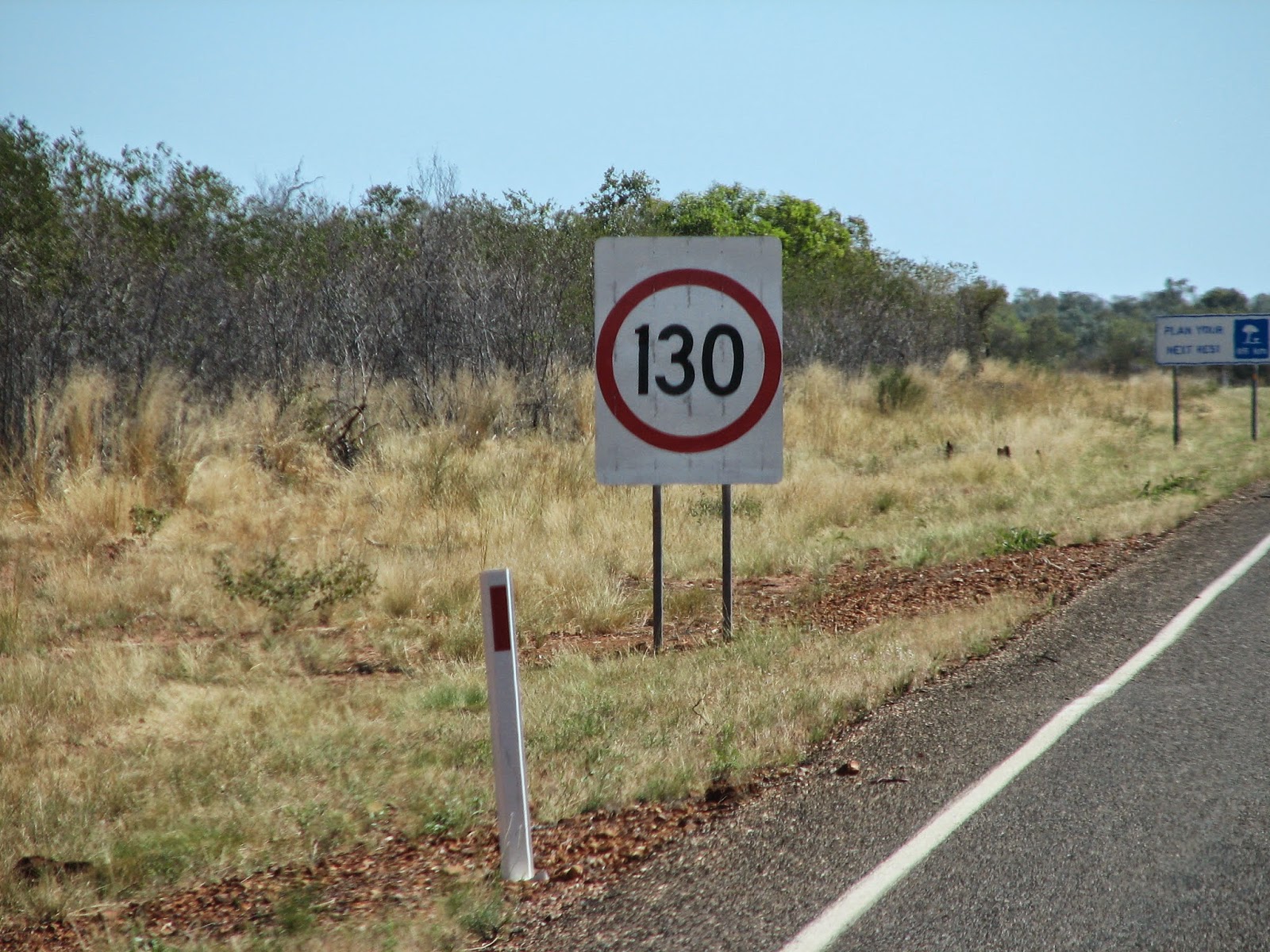
  • speed limit 130km/h once you cross the border into the Northern Territory
  • roads excellent but we restrained ourselves to 100km/h
  • a lot of trucks on the road were moving cattle - we actually passed one
  • diesel price at Barkly Homestead is 209.9c/l
290414 Mount Isa and the mine at twilight

290414 Georgina River west of Camooweal

290414 Georgina River west of Camooweal, on its way to Lake Eyre

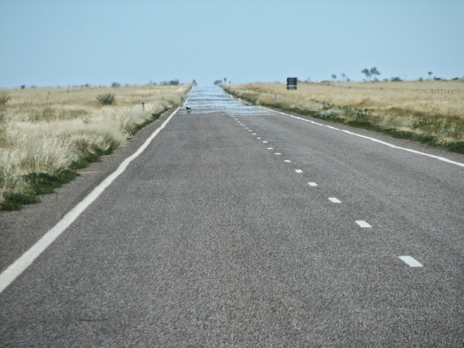
290414  Barkly Highway, yellow grassy plains and a mirage

290414 A welcome sign west of Camooweal

290414 Rankin River east of Barkly Homestead

290414 New speed sign for us

290414 Barkly Homestead - an welcome oasis in the outback

Sunday, 27 April 2014

Day 22 At Mount Isa

Another "administrative" day today but we took the time out to visit "Outback at Isa" to finish our tour of the Mount Isa history museum and the Riversleigh fossils display.  No pictures allowed here.  We also took in the view of Mount Isa mine and the town from a hill-top within the town.  Hot again at 35deg C with a cloudless blue sky.
280414 Mount Isa Mine and the town in the foreground 


280414 Mica Creek power station about 20km outside Mount Isa

280414 Every country town has a racetrack, including Mount Isa

Day 21 At Mount Isa

Today we relaxed, in the morning anyway.  We went to Lake Moondarra, the water supply for Mount Isa.  It was Sunday but there were few locals there and only one boat on the water.  It was quite spectacular given there was a large body of water in a seemingly dry and barren place. This afternoon we did a tour of the Hard Times Mine.  There are no longer tours of the main mine so, for the benefit of tourists, an underground mine has been constructed in the town.  It is all but the real thing and we were suitably dressed with all the right equipment. The guide demonstrated use of all the mining equipment and we even had afternoon tea in the "cribb room". Hot again today with blue skies and heaven of heaven, no flies.
270414 Lake Moondarra at Mount Isa


270414 Lake Moondarra at Mount Isa

270414 Wild peacocks at Lake Moondarra at Mount Isa

270414 The Gnome at Lake Moondarra at Mount Isa

270414 A colourful cliff at Lake Moondarra

270414 Dressed to kill (photo of a photo)


Friday, 25 April 2014

Day 20 - Cloncurry to Mt Isa

Fine day but hot and humid.  A carefree 120km drive across excellent roads had us in Mount Isa.  We passed through a pretty spectacular countryside with a kaleidoscope of "traditional" outback colours, browns, ochres, yellows and whites spread across rocky outcrops, weathered valleys and rolling hills.  Highlighted against this background were the green trees and their grey trunks and branches.  The picture was completed with an azure blue sky and an occasional fluffy white to grey cloud.  We descended from a high spot on the road into Mount Isa.  That was a sight to see.  More of Mount Isa in the next couple of days.
260414 Cloncurry River


260414 Cloncurry River

260414 Rock outcrop on the way to Mount Isa

260414 A mountain range between Cloncurry and Mount Isa

260414 A mountain range between Cloncurry and Mount Isa

260414 About to cross the Leichardt River near Mount Isa

260414 Mount Isa 

Thursday, 24 April 2014

Day 19 - Return to Cloncurry

Anzac Day - Lest we forget.  Today was a "deja vu day" as we retraced our tracks 380km from Normanton to Cloncurry - an uneventful trip.  Overcast skies but no rain, so traversing the one lane bits of the road did not cause us any problems when faced with approaching traffic.  Some trivia, there are 50 floodways in the 179km from Normanton to Burke and Wills intersection, compared with 24 from Burke and Wills to Cloncurry.  This gives an indication of the Gulf Country waterways on what is a very flat countryside south of Normanton. One of the creeks was called "Hazel Creek".  Given Noel's Mum's name is Hazel, we could not resist the photograph. Looking at a beautiful dark pink bougainvillea outside our van. Oh, the smaller prawns from Karumba were excellent.
250414 coming off the very flat Gulf Country plains


250414 Termite mounds - mile after mile of them

250414 An irresistible photograph, south of Normanton
250414 Bougainvillea outside our van in Cloncurry

Wednesday, 23 April 2014

Day 18 Karumba - the "Outback by the Sea"

Today we woke to the patter of rain on the roof and it lasted until after lunch.  Undaunted we headed off to Karumba, 73 km away. Excellent road all the way.  Karumba, population of 600, is a fisherman's paradise with barramundi the target.  Also big prawning industry but "all the big ones go overseas" so we were a bit disappointed with their size.  Mud crabs abound as well. We dined on barramundi for lunch - par excellence.  Prawn salad for dinner tonight. At Karumba, Century Zinc has a collection and roasting facility for zinc and lead, produced at its Century Mine 300km away.  The final product is ferried by a largish ship, MV Karumba, to larger ships anchored in deeper water in the Gulf.  The road to Karumba was along flat countryside which in some cases was covered with water.  Numerous creeks and billabongs criss-cross the area and water lilies were prolific.  Did not see a crocodile, other than Krys the Savannah King, whose statue, all 8.3m of it, graces the main street of Normanton. It is a full scale replica and to say the least, it is huge.  It is the largest salt water crocodile ever seen in the world.  


240414 Century Zinc's Facilities at Karumba Port

240414 Shopping centre at Karumba

240414 MV Korumba taking zinc concentrate to load in the Gulf

240414 Wildflowers and lilies in a lagoon near Normanton

240414 White water lily and reflection - Normanton

240414 Krys the Savannah King 8.3m long - and the Gnome - at Normanton

240414 At Normanton - Think its called "The Purple Pub"

Day 17 Fullarton River North to Normanton

450km today to arrive in the Gulf Country at Normanton, via Cloncurry, Quamby and the Burke and Wills Junction (BWJ).  We had a changing vista all day from dry treeless plains in the morning to tree-filled plains in the afternoon.  Around Cloncurry there were very interesting rock structures.  We stopped at Chinaman's Ck Dam Recreation Area  five minutes from Cloncurry.  It was beautiful.  After BWJ we experienced some rain which made the sides of the road muddy and yes, we met cars going in the opposite direction at places where the road was one lane wide.  The result, a muddy caravan.  Diane had our first communication on the two way radio.  A truckie was warning us to stay on the road as a couple of caravans were bogged on the verge when moving over to pass. "Roger that, over and out".
230414 Confusing - which highway is it?


230414 Rock structure near Cloncurry

230414 Chinaman's Creek Dam outside Cloncurry

230414 Touring the Top End by bike. Note the bear hanging on for grim death at the back

230414 Burke and Wills Junction Roadhouse

230414 Road train - some are even bigger

230414 A bustard on the roadside near Normanton

Monday, 21 April 2014

Day 16 - Winton to 60km south of Cloncurry

290km along the Landsborough Highway via Kynuna and McKindlay found us at a freepark at Fullarton River North, 60 km from Cloncurry.  It's in the middle of nowhere but there are two other vans here so we are relaxed.  Road has been excellent and the weather perfect. We have passed through mile after mile of flat grasslands with trees only existing around the creeks, most of which are dry.  At McKinlay we passed by the infamous Crocodile Dundee hotel.  No crocodiles within cooee of the place. Yesterday afternoon we completed our Winton experience with a visit to the musical fence.  Diane played Waltzing Matilda on it with a piece of wood and a rubber tube. There were many other percussion instruments at the site all natural like petrol tanks, hub caps, various barrels and many, many more.
210414 The Musical Fence at Winton


210414 Other percussion instruments at the Musical Fence

220414 Landsborough Highway near Kynuna - interesting topography

220414 Readily named hill off the highway near Kynuna

220414 The "Crocodile Dundee" Hotel at McKinlay south of Cloncurry