Pages

Friday, 11 November 2016

9 November 2016 - Noccundra to Cameron’s Corner


Another beautiful day saw us leaving at 6.15am for the 240 km drive to Cameron Corner.  Yes, we threw caution to the wind, even though we knew it was 240km back again.

FYI - Noccundra has no internet, we can’t get radio or TV and our mobile phones are useless, so we are blissfully in the dark.  We could arrange a special internet account but why bother.  No news about the American election is OK by us.

Back to important matters.  Cameron Corner is the point at which the borders of New South Wales, Queensland and South Australia intersect.  More of that later.
091116 Today's trip, follow red line from Noccundra
to Cameron Corner
091116 We are on the correct road - phew!
The first 10km of road were bitumen and thereafter, gravel.  There were countless floodways with occasional creeks, some with water pools evident from the roadway.  We were therefore stopping frequently to go slowly through the rough, washed out sections of the road. It took us 4 hrs 30 min to travel the 240 km but that was longer than the return trip of 3hr 40min, because we stopped to take photos on the way. The road was “not too bad” by SWQ standards and it was not wet!  It was very dusty in places however.

091116 A bit stony but look at the horizon
091116 A better part of the road
091116 Not so good road
091116 Looks good but bone shaking
091116 The road was downright dangerous here
091116 Pool at a creek crossing
091116 Almost dry creek bed - road was almost
as rough at this point
The scenery was quite impressive with hundreds of square kilometres of rolling plains, covered in small trees, wildflowers in all the depressions where water flowed and greenery of various sorts.  Yes, this area too, was showing the benefits of the unusual winter rain.
091116 Wild flowers
The herbage must be good for the cattle because they were in excellent condition.  Refer our earlier discussion with the road-train drivers who were delivering 600 cattle from Western Australia to this area for fattening.
091116 Another healthy one
091116 The whole herd looked healthy

Cameron Corner consists, et al, of a pillar marking the position of the borders’ intersection.  There were explanatory billboards about Mr Cameron, the site’s namesake, the dingo fence which passes by the site, how to survive in the outback etc etc. 
091116 Approaching Cameron Corner from the east

091116 One of the several border signs at Cameron Corner
091116 A foot in each Qld and NSW and a hand in SA
091116 Plaque at Cameron Corner

091116 This is what it is all about
091116 The Dingo Fence

091116 Land Types & Soils
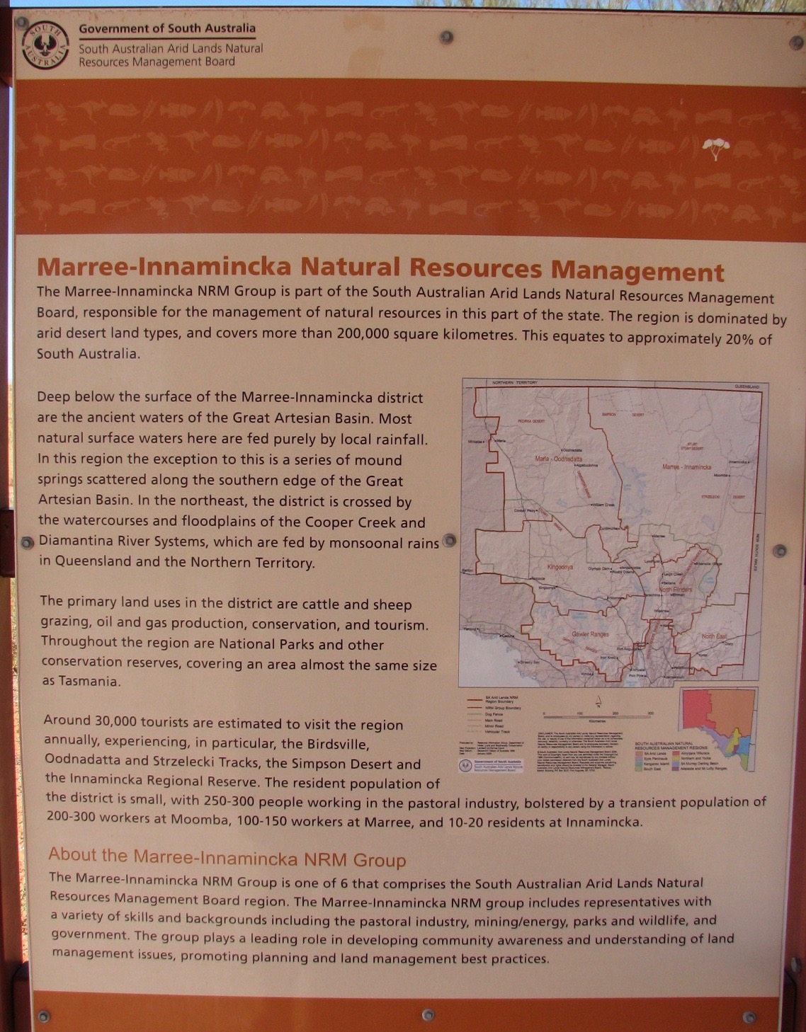
091116 The environment
091116 Self explanatory


091116 Who was Cameron?
091116 The Dingo Fence
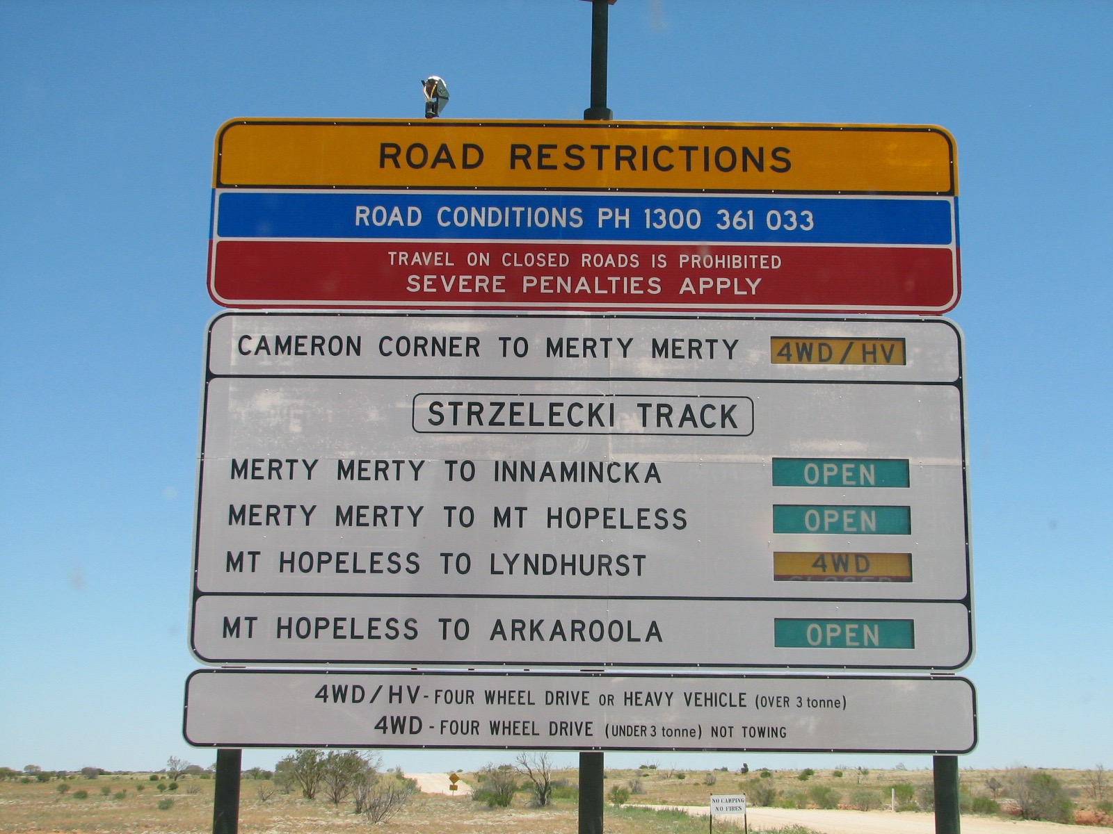
091116 Like the names Merty Merty and Mt Hopeless
091116 On the NSW side of the border
091116 Gate through the Dingo Fence

091116 Nest of Fairy Martins, a type of swallow,
in the display area

091116 A Fairy Martin
091116 A Zebra Finch at the Corner
Most important though is the Cameron Corner Store.  The Store provides food, accommodation, good advice, good humour……. and fuel at $2.40/litre.  Its ceiling was lined with caps and hundreds of bank notes of many denominations.  The money is harvested from the ceiling once a year and given to the Royal Flying Doctor Service.  There is also an airstrip at the corner and a three-hole golf course, where, for a fee, you can play Tri- State Golf.
091116 Cameron Corner  buildings
091116 The developer of the store
091116 Caps adorn the walls and ceiling

091116 More caps
091116 Bank notes on the ceiling
We are glad we did the trip and saw the countryside bedecked in flowers and greenery and to see such contented cows and bulls and, without doubt, graziers.  To be able to be in three states at the one time is quite and experience


8 November 2016 - Thargomindah to Noccundra

It was overcast today, with the clouds inviting rain.  None eventuated during the trip, save for ten and three quarter spots on the windscreen as we neared Noccundra.  The trip was a mere 140km from Thargomindah through mulga country.  The customary flat countryside was with us again, until we reached Grey Range, elevation 190m. It was a change to drive the 50 or so kilometres through some topography.

081116 Self explanatory.  The range is a large elevated section
running north south for hundreds of kilometres,
 east of the Channel Country
081116 More flat country west of Thargomindah

From an occasional high spot on the road we could see the “vision splendid”, thousands of square kilometres of flat countryside as far as the eye could see.

081116 Between Thargomindah and the turnoff to
Noccundra - typically pale green
081116 More green
081116 From a rise in the road - a lot of flat country up ahead -
Channel Country
The land was showing the benefits of winter rain with touches of green and the yellow, white and green of wildflowers.  We must have passed 40 “Road subject to flooding.  Indicators show depth” signs, and we haven’t reached Cooper Creek yet.

This is predominantly cattle country.  We saw relatively few cattle, even though there are thousands roaming around the countryside.  They all look very healthy.

081116 One beast
081116 Or more beasts
We were fortunate to get a shot of a wedge-tailed eagle, which flew from the roadside as we approached.  Its mate was nearby but was airborne very quickly, too quickly for the camera anyway.
081116 Magnificent - a lucky shot.  These birds are huge!
We arrived at our destination, Noccundra, late morning.  It is 20km off the “main road” and comprises one hotel, three residents, three cats and two dogs.  It services the locals and transport drivers for the sheep, cattle and oil industries.  Why visit Noccundra?  It has fuel for sale.
9081116 Noccundra Town - all of it
10081116 Noccundra Hotel - our home for three nights
In the afternoon, we braved the heat and the flies and walked the 300m down to Naccowlah Waterhole, one of three large waterholes on the nearby Wilson River.


12081116 Noccundra Waterhole Wilson River
13081116 Noccundra Waterhole Wilson River
11081116 Noccundra Waterhole's resident pelican (damaged wing)
Noccundra is the meeting place for many road train drivers.  The rigs are huge and they cover huge distances.  We spent time with drivers of the rigs photographed and a lively time was had by all.  They had just brought 800 cattle over from Western Australia to be fattened, "just up the road" at Naryilco Station.

081116 Inside the named hotel
081116 The road-train drivers agree
081116 There are two road trains here.  Each one can carry
200-300 larger beasts or up to 600 weaners.  Get 900 metres
to a litre of diesel and carry 1200-1500 litres of fuel

We realized that Cameron Corner is 250km from Noccundra.  Will we go or won’t we?  It’s dirt all the way but…… it’s there! Will it be too hot?  Why wouldn’t you go, having driven 1360km to get here?  If we don’t go now will we ever come back?  There were the questions confronting us as this blog goes to publication.